2022-08-30 00:30
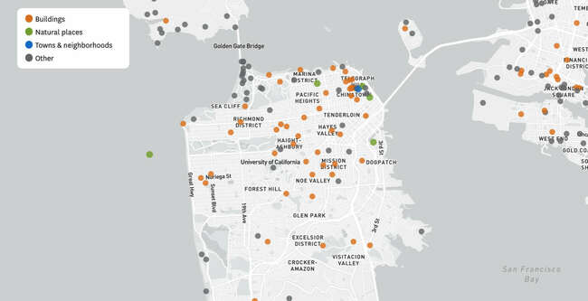
This San Francisco map shows famous sites that have been renamed or no longer exist
Each circle represents a place that no longer exists or has a different name. Hover or tap on a circle for details. Select a button to filter by a feature type. Source: Geographic Names Information System (GNIS) All features appear as points on the map, even if they took up acres of land. GNIS stopped collecting data on the following location types in 2014: airport, building, cemetery, church, dam, harbor, hospital, mine, park, post office, school. As a result, the map may not include places of these types that closed after 2014.
https://www.sfchronicle.com/projects/2022/sf-bay-area-historical-names/
#sfchronicle
https://www.sfchronicle.com/projects/2022/sf-bay-area-historical-names/
#sfchronicle
You must login before you can post a comment.